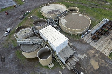
 Our unmanned aerial inspection systems feature state of the art drone technologies equipped with live streaming video with high definition cameras for photo and video capture. We can inspect high voltage aerial feeders, towers, columns, flares, wind turbines, bridges, buildings, pipelines, construction sites, real estate and even internal inspections of storage tanks, boiler furnaces and buildings.
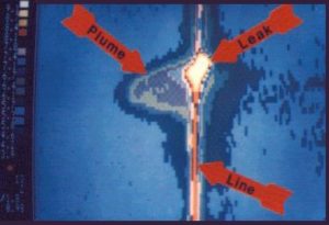 We can also mount fully radiometric infrared cameras on our drones for thermal evaluations of high voltage equipment, live flares, above and below ground pipe lines, boilers and furnaces, roof moisture surveys and building envelopes.
 Scaffolding is expensive and confined space entries and elevated work are dangerous. Unmanned aerial inspection technologies can reduce personnel hazards and cut inspection costs in half.
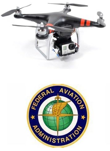
Our fully insured drone pilots are experienced FAA licensed pilots.
 We are one of the few companies approved by the FAA for commercial drone operations and we have a significant amount of experience using drones for industrial inspections. Now we want to make our experience with drones available to the construction industry.
 McKinsey reports that most projects are 20% over schedule and 80% over budget. We’ve learned that drones are the most efficient way to obtain the project data you need to stay on schedule, on budget and on design. Drones can survey a site 6 times faster than conventional methods. And the quality of the data is unparalleled. A single flight can collect all the data needed to produce 2D orthomosaics, 3D point clouds and digital surface models.
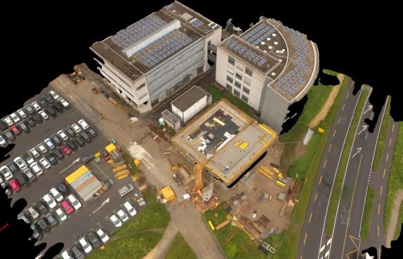 Building Information Modeling (BIM) – Using ground control points, our drones can survey and develop as-built site data accurate to within ¼”. We can create orthophotos and 3D digital models and integrate our imagery into your CAD programs. We can produce progressive shoots and timelines that document the entire project from beginning to end.
Building Information Modeling (BIM) offers enormous gains in cost and time savings, better estimate accuracy, reduction in errors and re-work and we can link your schedules and budgets to our models. And cloud based data lets all stake holders collaborate and monitor, eliminating those time consuming site visits.
 In 2015, OSHA reported 927 construction fatalities in the US. 40% were from falls. Many of our clients have found that our drone surveys have become an important part of their effort to improve on the job safety. Preventing one OSHA recordable pays for the cost of many drone surveys.
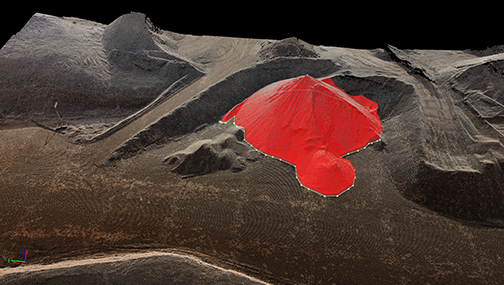 Earthworks – Using our drones, we can develop accurate topographical maps and 3D digital surface models. We can provide precise volumetric and cut and fill analysis, stockpile measurements and contour data. We can survey earthworks quickly, easily, and accurately.
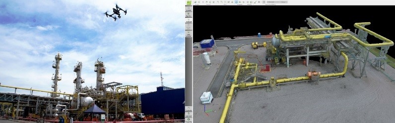
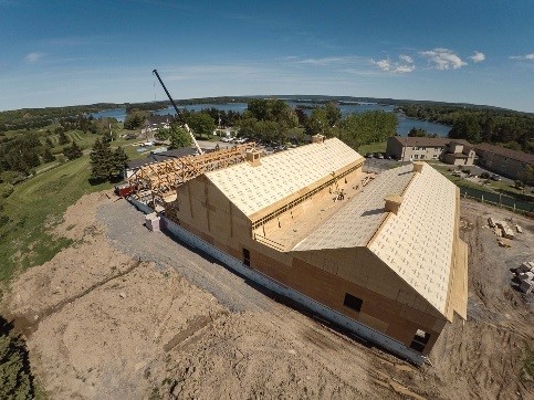
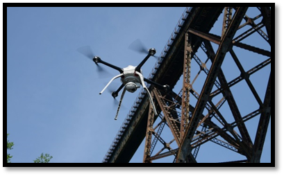 Inspection – Our drones give us access to difficult to reach areas without risk to personnel. We can locate defects in 3D and analyze structural details from multiple angles. Our high definition cameras produce videos and imagery with incredible detail.
Better project management.
Better planning, sequencing, scheduling and logistics.
Better productivity tracking and optimization.
Better stakeholder collaboration.
Better project compliance and documentation.
Better QA/QC.
Better job site safety.
Reduced rework.
Better sub contractor management.
Easier disputes resolution.